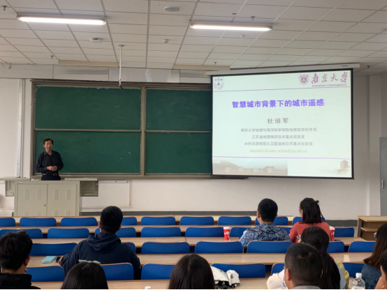
at the invitation of the college of earth and environmental sciences, lanzhou university, professor du peijun of the department of geographic information science, school of geography and ocean sciences, nanjing university, visited our university on september 12 to 13, 2020. in the afternoon of 13th, prof. du gave an academic report entitled “urban remote sensing under the background of smart city” in the building tianshantang of yuzhong district. the report was chaired by nian yanyun, deputy director of the department of geography.
starting from the background and national needs of urban remote sensing, prof. du introduced the current situation of urban remote sensing development at home and abroad, and the framework of urban remote sensing research from the perspective of geography. finally, he introduced the development and thinking of urban remote sensing. from descriptive to explanatory, then from diagnostic to predictive, remote sensing should ultimately provide decision-making for urban development. based on his own study experience and research experience, prof. du has put forward some suggestions on study and work for undergraduate and graduate students. after the report, du interacted and communicated with the undergraduates majoring in geographic information science and the graduate students majoring in cartography and geographic information system (gis) of our college, and answered the questions that students concerned about.

biography:
du peijun, dean of the department of geographic information science, school of geography and ocean sciences, nanjing university, professor and doctoral supervisor, deputy director of the key laboratory of land satellite remote sensing application, ministry of natural resources. he is also the deputy chairman of the professional committee of photogrammetry and remote sensing of the chinese society of surveying and mapping, the member of the national committee of china (cnisde) of the international digital earth society, and the deputy chairman of the professional committee of earth observation of imaging spectrum.
he is mainly engaged in urban remote sensing, geographic information science research, having presided over more than 20 projects of the national natural science foundation of china, national 863 program subjects, work projects of china geological survey, etc. he has made abundant research achievements in urban remote sensing, intelligent interpretation of remote sensing images, hyperspectral remote sensing, and integration of geographic information technology, having published such monographs as "integrated methods and applications of remote sensing multiple classifiers", "remote sensing methods and practices for urban environment", and "research on hyperspectral remote sensing image classification and application of support vector machines".in addition, he has published more than 240 research papers, including more than 110 sci papers and more than 60 ei papers. he has won 2 national excellent teaching achievement awards, 8 provincial and ministerial scientific research awards, and more than 10 authorized invention patents and software 凯发k8官方旗舰厅 copyrights.