the party committee propaganda department (news center) of lanzhou university newly opened a “science headline” column, focusing on the major scientific frontier issues, key technology and application breakthroughs, reporting the important innovations of lanzhou university in basic and applied research, and serving the country and local economic and social development. the following is from the scientific headline.
the yellow river is the fifth largest river in the world and the second-largest in china with a length of 5,464 kilometers. in the long history, when did the yellow river begin to appear? what kind of "fate" has she experienced? what is the relationship between her formation and the climate and environment at that time? where does the sediment in the middle and upper reaches of the yellow river come from?
the geomorphology and quaternary environment research team of lanzhou university led by professor pan baotian answered these questions after nearly 30 years of in-depth research. the team's achievement "research on water system development and environmental change in the middle and upper reaches of the yellow river" won the first prize of the 2019 higher education scientific research outstanding achievement award (science and technology).
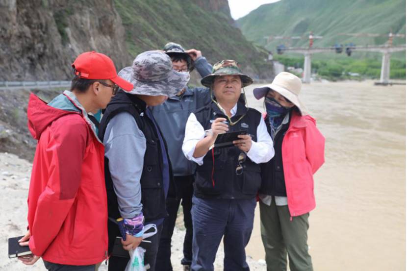
the research team worked in the field
how did the upper and middle reaches of the yellow river form?
pan baotian, the team leader, believes that it is necessary to start with evidence to determine when the yellow river appeared. the river terrace is the ancient floodplain in the past, which is the most direct evidence of the formation and evolution of the river. from the earliest river terrace formation time, it can be roughly inferred that the yellow river appeared.
in the lanzhou section of the yellow river, the team dated the formation age of the highest level of the yellow river terrace, which revealed the age of the yellow river to about 1.8 million years ago. then, the team conducted a systematic study on the geomorphic records of 9 basins and 17 key river sections along the middle and upper reaches of the yellow river, and constructed a你accurate chronological framework of river valley development, using paleomagnetic, cosmogenic isotopes, optical stimulated luminescence, radiocarbon, etc. dating methods.
this research work provides chronological data and research paradigms for understanding the development of giant water systems and the evolution of watershed geomorphology and clarifies the typical patterns of river systems responding to tectonic activities.
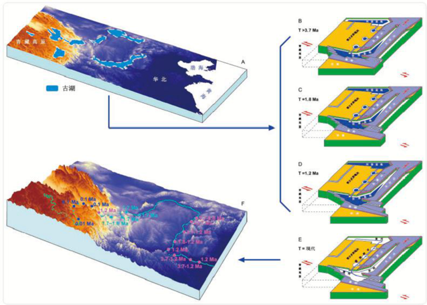
conceptual model of river system development and regional structure and landform evolution in the middle and upper reaches of the yellow river
where did the driving force for the formation and evolution of the middle and upper reaches of the yellow river come from?
the evolution of the river system is always associated with regional tectonic movements and climate change. in the initial research, the group mainly analyzed the driving force from the perspective of the tectonic movement. around 2000, nie junsheng, hu zhenbo, hu xiaofei, gao hongshan, and guan qingyu successively joined the research team, in-depth cooperation in tectonic movement, climate change, river system evolution, tectonic landform, terrace development, modern environment, etc., to comprehensively explore the reason of the middle and upper reaches of the yellow river reasons for evolution.
by comparing and analyzing the topsoil susceptibility and modern climate records, the team constructed new paleoclimatic substitute indicators (environmental magnetism parameters), successfully distinguishing temperature from precipitation changes information in the red clay, and restored the records of precipitation of the middle and upper reaches of the yellow river in the late cenozoic.
faced with the results of the data analysis, the team continued devoted many years of research to a comprehensive analysis of east asian climate records, changes in pacific temperature and salinity, the evolution of atmospheric carbon dioxide concentration, and climate simulations. after that, they proposed a new hypothesis for a large increase in ice caps in the northern hemisphere.
the pliocene climate change trends and related mechanisms in the chaonahong clay section in the upper and middle yellow river
where does the sediment in the middle and upper reaches of the yellow river come from?
the yellow river has the largest sand content in the world. in recent years, under the influence of climate change, desert expansion, reservoir storage, and excessive water use, in addition to the downstream channels, the inner mongolia section of the upper yellow river has also rapidly developed into a "new hanging river". it is of great theoretical value to discuss the sources and transport processes of sediment in the yellow river basin, and it has more practical guiding significance in the ecological management of the river basin.
the study found that most of the material transported from the tibetan plateau by the yellow river in the early quaternary did not reach the middle reaches, and was mainly deposited in the yinchuan-hetao basin. the material in the upper yellow river did not contribute much to the sedimentation of the north china plain.
it is determined through large samples and multi-index analysis of surface materials that the silt and sediment of the modern channel of the yellow river ning-mongolia section mainly came from the tributaries and deserts along the line. the wind blew and water transport constituted the main cause of sedimentation in the ning-meng section of the yellow river in the time scale of modern engineering.
this study organically links the formation and evolution of the entire middle and upper reaches of the yellow river with changes in the basin’s environment and can provide scientific support for ecological protection and high-quality development of the national yellow river basin.

the silt and sediment tracing and contribution rate of resource areas in the yellow river in ningxia-inner mongolia at various space-time scales